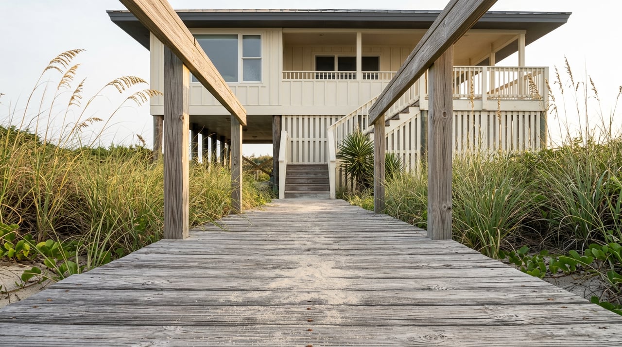
If a stretch of Hilton Head Island beach just gained more than 100 feet of new sand, why can't a homeowner build a pool, a bedroom addition, or a rebuilt storm deck 100 feet closer to the water than they could last year?
That question is showing up in more conversations this year as the Town wraps its first full beach renourishment in a decade. The sand is real. The wider beach is real. But the line that actually controls what you can build, rebuild, or add on an oceanfront lot has not shifted, and by state law it cannot shift just because a dredge pumped fresh sand onto the shore. For anyone evaluating a beachfront or near-beach property on Hilton Head right now, that gap between what the beach looks like and what the parcel is legally allowed to hold is the thing worth understanding before you write an offer.
The project that actually widened the beach
The Town of Hilton Head Island spent the 2025-2026 season on a $47.5 million renourishment project, placing roughly 2.2 million cubic yards of sand along about 46,500 feet of Atlantic Ocean and Port Royal Sound shoreline, according to the Town's own project page. Olsen Associates, Inc. handled the engineering and Marinex Construction, Inc. built it, with funding drawn primarily from the local Beach Preservation Fee and accommodations tax rather than general property tax revenue.
The work moved in phases:
| Phase | Area | Sand placed | Status |
|---|---|---|---|
| 1 | Port Royal (The Heel), Fish Haul, Pine Island | ~730,000 cubic yards | Complete by the end of 2025 |
| 2 | Central Island (including beach areas along Palmetto Dunes), South Island, South Beach | ~1.45 million cubic yards | Complete May 2026 |
| 3 | Six rock breakwaters on the Port Royal Sound shoreline of Hilton Head Plantation, between Dolphin Head and Pine Island | Hard structures, not sand | Timing still to be determined in 2026 |
As of April 2026, WTOC reported the project was entering its final phase, moving crews to the south end of the island after roughly eight months of continuous work. The Town's communications director told the station the results were already visible, describing stretches where crews had added "more than 100 feet of beach that has been added." Portions of Islanders' Beach Park were closed to vehicle traffic and parking starting in late October 2025 to stage the pipeline used to move sand ashore, a detail that matters mostly to anyone who parks there but is a useful marker of how physically large this project was.
Why the wider beach and the buildable line are different things
Sand is not the same thing as a legal setback. The South Carolina Department of Health and Environmental Control's Office of Ocean and Coastal Resource Management, known as DHEC-OCRM, holds direct regulatory authority over the state's coastal waters, tidelands, and beach and dune systems. Under the 1988 South Carolina Beachfront Management Act, DHEC-OCRM draws two lines for every beachfront parcel: a baseline, generally set at the most landward position the shoreline has occupied over the past 40 years, and a setback line measured landward of that baseline.
The setback formula is not arbitrary. Beachapedia says it equals the average annual erosion rate multiplied by 40, which in high-erosion zones has produced required setbacks of close to 400 feet. On stable or accreting beaches, the minimum setback is 20 feet landward of the baseline. That line, not the current edge of the water, is what a building or zoning permit measures against.
Here is the part that catches buyers off guard. State law requires DHEC-OCRM to review and potentially adjust these baseline and setback lines only once every eight to ten years, and a 2016 change to state law now prohibits the baseline from moving seaward at all after December 31, 2017. So even though the 2025-2026 renourishment visibly pushed the water's edge outward in front of many homes, the legal baseline behind that new sand stays put. The Town's own Beach Management Plan is explicit that this is intentional, stating that renourishment is not meant to open the door to development moving seaward.
What actually moves a setback line
Two things can change where a beachfront setback sits. Sand delivered by a renourishment project is not one of them.
- The statutory review DHEC-OCRM conducts on its eight-to-ten-year cycle, which can adjust lines based on updated erosion-rate data across the whole zone, not one property.
- A change in state law itself, the way the 2016 legislation locked baselines from moving seaward regardless of what happens on the beach in front of them.
Pumping 2.2 million cubic yards of sand onto the beach does not appear anywhere on that list.
Two lots that look similar today and are not
The renourishment treated different parts of the island differently, and that difference matters for anyone comparing two beachfront lots that look equally wide right now.
Pine Island, inside Hilton Head Plantation, received both sand and six rock breakwaters built along its Port Royal Sound shoreline. Breakwaters are a hard structure meant to hold sand in place longer than an unprotected beach can. A stretch like South Beach or Port Royal's Heel got sand only, which means it will erode on the same natural timeline as before, likely needing the next full renourishment on a similar eight-to-ten-year cycle the way the 1990, 1997, 2006, and 2016 projects did.
Two owners closing this year on lots that both look freshly widened are not necessarily buying the same long-term erosion picture. A buyer comparing a Pine Island parcel to a South Beach parcel is comparing a lot with structural reinforcement to one that depends entirely on the next scheduled sand delivery, whenever that gets funded and scheduled.
What this means before you write an offer
None of this changes whether a home is livable or sellable today. It changes what you should verify before you write a contract that assumes future work: a pool addition, a rebuilt deck after storm damage, a second story, or any expansion of the footprint on a beachfront or near-beach lot.
Before making an offer contingent on future construction, ask the seller for the most recent recorded OCRM baseline and setback determination for that specific parcel, not a general sense of how wide the beach looks in photos. A coastal-experienced land surveyor can confirm where the current legal line sits relative to the existing structure and any proposed addition. That single step tells you whether the improvement you are picturing is actually permittable, regardless of how much new sand sits between the house and the water this year.
This is the kind of detail that belongs in due diligence, not in the excitement of seeing a wider beach on a showing. It is also exactly the kind of question worth raising with your agent before you write an offer, not after.
A short FAQ
Does the renourishment change the line that governs new construction? No. The renourishment adds beach in front of the legal setback line. It does not move the line that governs new construction.
If my home already sits seaward of the current setback line, what should I verify? Confirm how the current line applies to your home with a coastal-experienced surveyor or directly with DHEC-OCRM.
Will the setback line ever move seaward because of this renourishment? Not under current law. The 2016 legislation prohibits the baseline from moving seaward after December 31, 2017, regardless of how much sand a renourishment project adds. Any future change would come from a statutory review cycle or a new law, not from the renourishment itself.
If you are looking at a beachfront or near-beach property on Hilton Head and want to understand what a specific parcel's setback line actually allows before you write an offer, Michael Sutcliffe can help you get the right questions in front of the right people. Schedule a consultation to start that conversation before your due diligence clock starts running.
This article is general information, not legal, tax or financial advice. Consult a qualified professional about your situation.